caltexflanc
Guru
Right on Ski. We once had a half mile or so circle our marina was in blacked out from GPs due to some military exercise going on. Another time, peacefully anchored out, this little series was drawn on the plotter:

K
That's how I understand it to work, but someone more knowledgeable can correct me...
Dangerous? Can you be serious??
How much changes on charts in 5, 10, 20yrs? Some channels, some markers, some ranges. Landmarks and bottom contours stay fairly constant.
So if you lose GPS signal, you would rather have no paper charts on the boat, updated or not?
You must not venture into areas with much lightning... Take a strike and you can lose most all electronics.
We've almost danced around this subject as much as anchors. For those who feel safer and more comfortable or just enjoy paper charts, then use them. Just make sure you make all updates and corrections before each voyage. Just don't imply that's the only way to safely navigate. I know people who still print out every email and everything they do on the computer because they like to mark on things or they're just more comfortable having hard copies.
Then some of us have grown up in different times. We started navigation in a time of advanced electronic systems and charts. We actually had to learn secondarily the use of paper and celestial navigation is a whole additional subject. But then outside of legal documents such as titles and deeds, we don't have any paper document files either, not personally or for our businesses. And, yes, we have things backed up in multiple locations and on multiple systems.
We all do what we're most comfortable and trained with. Hopefully we all have redundant methods of some sort.
Oh and we have no paper road maps either. I never could fold those things back. lol
May never need them, but it is like tools in the tool box.
.
:
- How up-to-date, really, are your paper charts? What I've found while walking onto other boats over the last 8+ years is that the charts are almost never newer than 3-5 years old unless the boat is newer to the owner than 5 years.
")
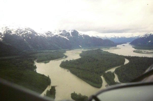
I have noticed a bizzare phenomenon over the last 36 years I have been flying and boating in this region from here up the BC coast and throughout SE Alaska. I realize this may be unique to this area only, judging by the "out of date" chart posts I see from time to time, mostly from east coast people. But all the bays, channels, passes, islands, rocks, reefs, points, spits, peninsulas, sounds, straits, inlets, shallow spots and deep spots, to say nothing of the mainland itself, are all exactly in the same place today as they were 36 years ago.
So I find this out-of-date-chart concern to be, as Shakespeare wrote, much ado about nothing, at least in terms of where the rocks and stuff are.
The exception I do give credibility to are the folks that boat rivers. My senior year in high school was spent at a co-ed boarding school in close proximity to the Mississippi River and I learned that that river is truly making things up as it goes along. So currency in charts, paper or electronic, is pretty important in that environment.
I think the most value I get from paper charts is to be able to see over a larger area but still have the detail. I have a problem sometimes getting an over view of an area that I can see on electronics.
I find the same thing on GPS in my car or on my phone- sometimes it would be nice to have a larger view of the area but still see the detail.
Well, you hit it in your "mostly from east coast people" and in your rivers comment but didn't give yourself credit or recognize the significance.
To make a blanket statement that paper charts are dangerous is absurd and indicates a very narrow view of the realities of boating.
Thanks.....I don't think so. In fact, the statement comes directly FROM the realities of boating. I'm in a unique position of being invited on hundreds of boats every year. I usually talk about charts and see what different boaters are using in different areas. We cruise through the year putting on between 2,500 and 5,000 nm each year.
.........edited out.......
Blanket statements are more about the realities of boating than any argument I've heard yet. Reality recognizes that most boaters honestly can't use the tools from the previous generation. To go even further, when I go onto a boat where someone boasts about using paper charts, again, there are no pencil marks or no tracking on the paper. It's rare to find the chartkit even flipped to the right page. They boast about using a tool that they don't honestly use but have some odd fear that they're not a "real" boater unless they claim they're in the "paper chart" camp. It's mostly BS. I'm just one of the first to stand up and call it that.
The significant trend I have noted is that culturally it has become acceptable to be dependent upon electronic devices instead of using them as tools.